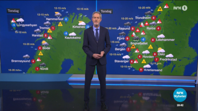
There was no lack of warnings about the threat of an extreme weather system that started hitting Norway hard on Wednesday. The high winds, blizzards and massive rain pouring down along the west coast were expected to continue into Thursday.

“This can get ugly,” Aart Verhage, a regional chief for the state waterways agency NVE told Norwegian Broadcasting (NRK).
The storm now named “Gyda” had already, by midday, forced closure of most all roads over the mountains from Vestlandet in the south to Nordland in the north. Ferries were cancelled, most shipping along the coast was cancelled and one of the coastal voyage line Hurtigruten’s ships, the Fridtjof Nansen, grounded in rough seas off Måløy with 398 people on board. All were later evacuated and there were no injuries.
Officials were most worried about avalanches being set off by a sudden rise in temperatures and pouring rain. “This is an extreme situation that only occurs quite seldom, and can cause great damage,” Elin Langsjolt of NVE’s flood warning division told NRK.
The storm has prompted NVE to send out Code Red alarms, its highest level of warning, for flooding, landslides and avalanches. The weather was due to get worse during the night.
Police were warning motorists against driving in most areas of Møre og Romsdal and Sør-Trøndelag. Others areas under direct threat included Salten, Svartisen, Trollheimen, Indre Fjordane, Jotunheimen, Indre Sogn, Voss, Hardanger, Heiane, Helgeland in Nord-Trøndelag, Nordmøre, Nord-Gudbrandsdalen and Ofoten.
Heavy snow was reported in Harstad while rain was posing the biggest threats farther south. Mobile phone coverage was out of order in some areas and one slide was already reported in the Geiranger-Hellesylt area.
newsinenglish.no staff

